
Our Mission
Funding
FUNDED PROJECTS
Donations
Who We Are
Completion of the Geomagnetic Prospection on the Prehistoric Tell Settlement of Berettyóújfalu-Herpály
Pál Raczky (Budapest, Hungary)
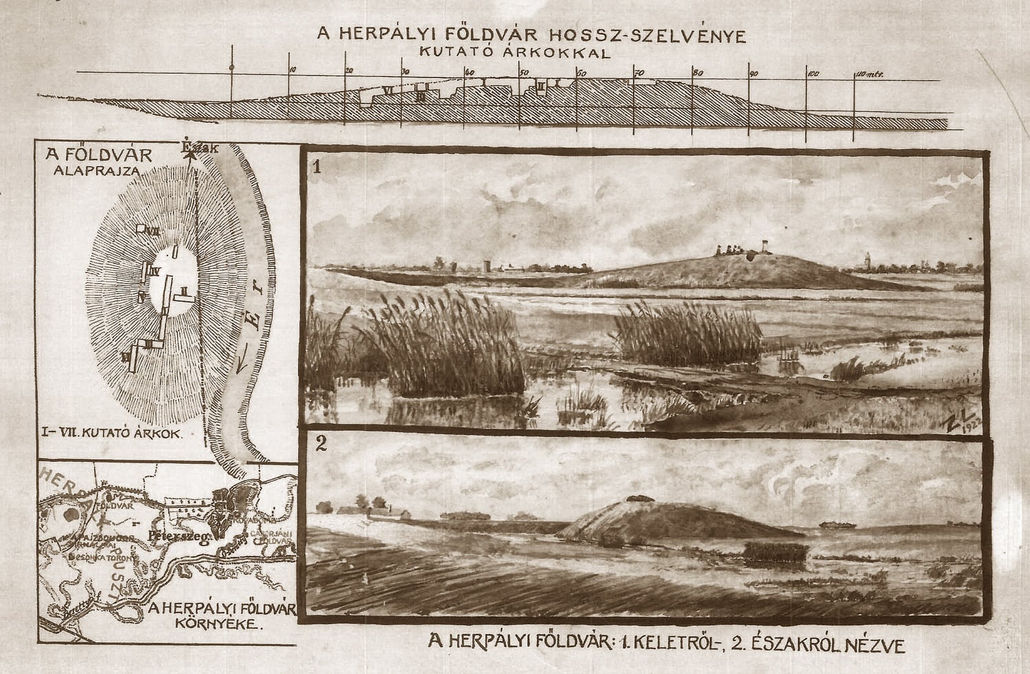
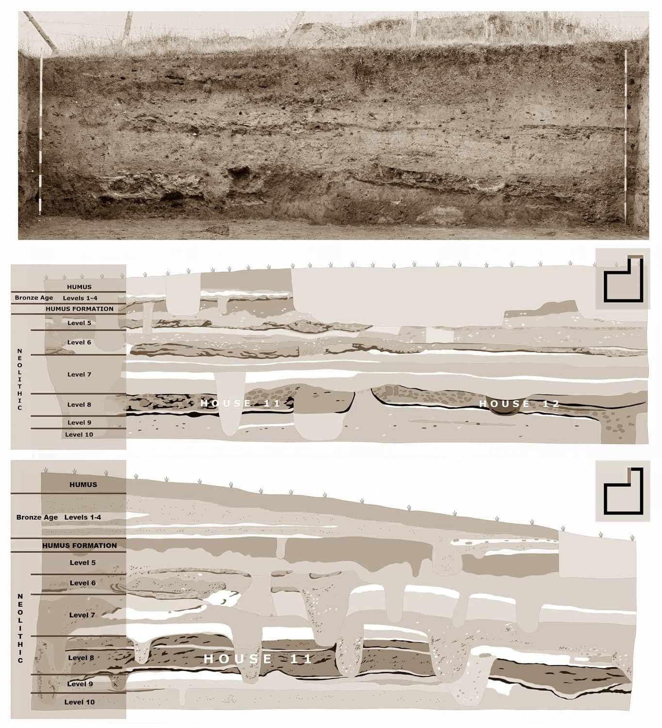
The prehistoric tell settlement of Berettyóújfalu-Herpály has long been well-known in European prehistoric research. Its particular interest lies in the fact that the almost 4 m deep stratum contains settlement levels from both the Neolithic and Bronze Age periods in the Berettyó region of the Great Hungarian Plain.
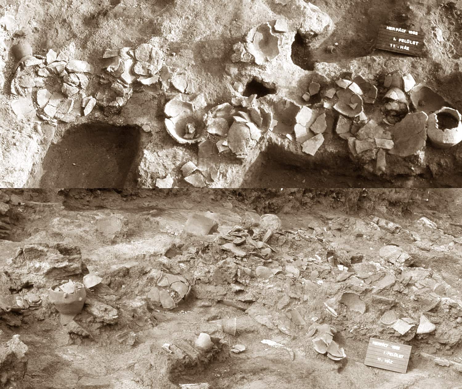
The excavations between 1977 and 1982 mainly concentrated on this tell settlement, and thus relatively little information was initially available on the relationship of the tell and its surroundings. A total of 600 m2 were investigated in the central part of the tell which extended down to the lowermost level.
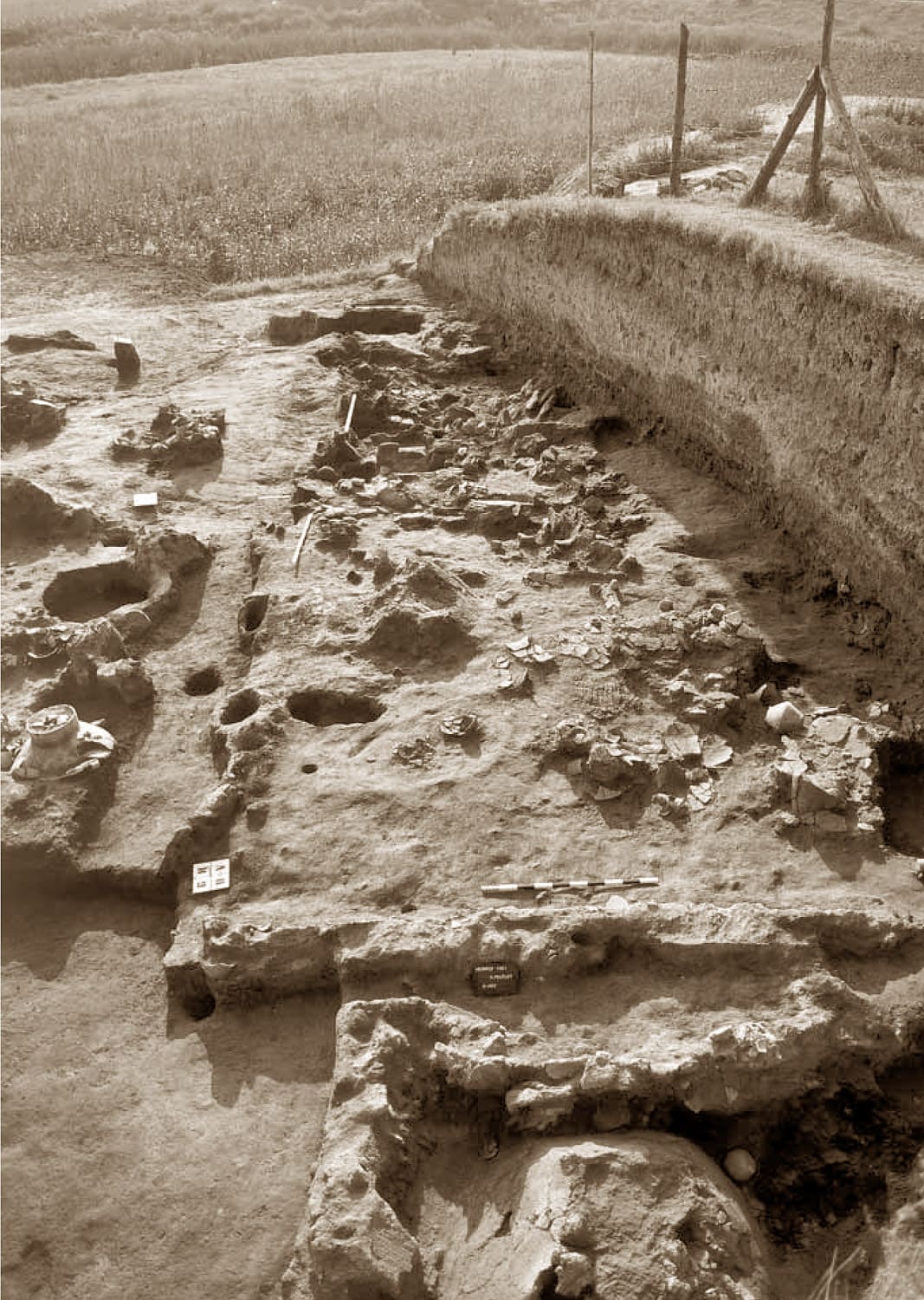
Lying beneath the Bronze Age levels was an unprecedented wealth of house remains from the Neolithic, whose burnt rubble had preserved the furnishings and the various household articles and tools once used by the occupants. There can be no doubt that the most spectacular elements of the building’s furniture were the ovens and plastered hearths representing various types.
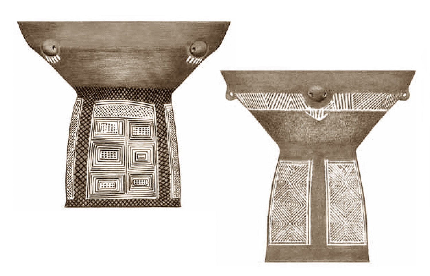
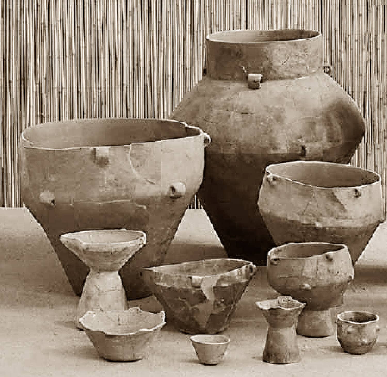
The most popular decoration of the Herpály pottery was painting, applied after firing. Mainly based on the special decoration style of the ceramics, the Herpály culture was defined as an independent Late Neolithic cultural unit parallel to the life of the Tisza and Csőszhalom cultures. The architectural importance of the two-storey houses discovered in the Neolithic levels must here be emphasized. The orderly arrangement of the wattle and daub houses tends to suggest some preconceived system of settlement planning inside the mound.
The use-life of the Neolithic tell settlement began at the turn of the 6th to 5th millennia BC, and by the mid-5th millennium BC the mound and its broader area were abandoned.
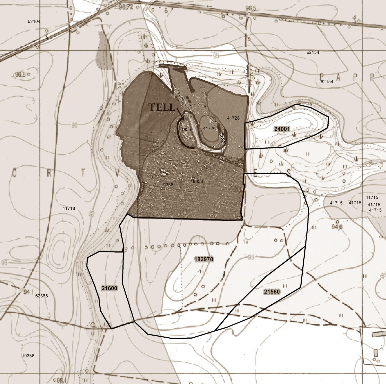
Previously, we conducted a series of field surveys in the broader area of the Herpály tell settlement. We found that the main settlement mound was surrounded by a 15 to 20 hectares large single-layer settlement. In the meantime, the change in professional approach and the expansion of technical possibilities together resulted in intensive and complex investigations being extended to the narrower and wider environment of the Neolithic and Bronze Age settlement mounds of the Carpathian Basin. As a result, it has now become clear that many settlement mounds are surrounded by smaller or larger single-layer outer settlements.
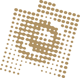
Driven by this demand in recent years a magnetic prospecting program was implemented in an area of 15 ha in the vicinity of the Berettyóújfalu-Herpály tell settlement. As a result, the settlement complex consisting of the tell and a single-layer settlement was demarcated in the north and west. With the support of FSPT an additional 25 ha of magnetic measurements will now be carried out to cover the entire extent of the site, i. e. to determine the southern and eastern boundaries as well.
Funding period: 2023